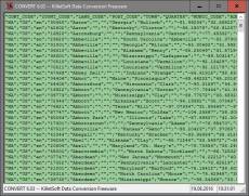
Geodata International - World-wide database of countries with georeferenced towns, municipalities, postal codes and administrative units with WGS84 and UTM coordinates and elevations for geocoding, proximity search, navigation, distance calculation. Often is it necessarily, for an address characteristic, e.g. the place name or the postal code, to establish a local relationship - a georeference. The georeference can be used e.g. to show a customer the nearest chain store by doing a proximity search. On the basis of the georeferences business zones, statistics or general maps can be made. Towns, municipalities and postal codes can be assigned to the superordinated administrative units. Distances between places or postal areas can be determined with the coordinates contained in the database tables. For that the georeferences are available in all country database tables as UTM coordinates on the natural and an uniformly meridian strip and as geographical coordinates in degree and deg/min/sec notation. With the elevation data from a Digital Elevation Model the ground level height of each place can be determined. The database tables are present in the file format CSV (Comma Separated Values). The character set used is UTF8. This format is used often and in most cases you can import data directly into your own data system. The freeware program CONVERT, downloadable from the KilletSoft site, converts the available database tables to other data formats and character sets with the necessary sortings and selections. With the program, for example, CSV data can be converted to the SDF format (Simple Document Format) or to the dBase format. For the use of the data on different platforms it is possible to select between the character sets ASCII, ANSI, UTF8 and UniCode. Thus the import of the data in any database management system or file system will be possible.
Geodata International - Wereldwijde database van landen met een geogerefereerde steden, gemeenten, postcodes en administratieve eenheden met WGS84 en UTM coördinaten en hoogtes voor geocodering, nabijheid zoeken, navigatie, afstand berekening. Vaak is noodzakelijk, want een adres kenmerk, bijvoorbeeld de plaatsnaam of de postcode, naar een lokale relatie op te bouwen - een georefereren. De georeferentie kan bijvoorbeeld gebruikt worden om een ??klant te tonen de dichtstbijzijnde winkelketen door het doen van een proximity zoeken. Op basis van de georeferences zakelijke zones, kunnen de statistieken of algemene kaarten worden gemaakt. Steden, gemeenten en postcodes kunnen worden toegewezen aan de superordinated administratieve eenheden. Afstanden tussen plaatsen of post gebieden kan worden bepaald met de coördinaten die in de database tabellen. Voor dat de georeferences beschikbaar zijn in alle landen database-tabellen als UTM coördinaten op de natuurlijke en een gelijkmatig meridiaan strip en als geografische coördinaten in graad en deg / min / sec notatie. Met de hoogte van gegevens van een Digital Elevation Model de begane grond hoogte van elke plaats kan worden bepaald. De database tabellen zijn aanwezig in de bestandsindeling CSV (Comma Separated Values). De gebruikte tekenset is UTF8. Dit formaat wordt vaak gebruikt en in de meeste gevallen kunt u direct gegevens importeren in uw eigen gegevens systeem. Het freeware programma CONVERT, te downloaden van de KilletSoft site, zet de beschikbare database tabellen voor andere data formaten en tekensets met de nodige sorteringen en selecties. Met het programma, bijvoorbeeld, kan CSV-gegevens worden omgezet in de SDF-formaat (Simple Document Format) of naar het dBase-formaat. Voor het gebruik van de gegevens op verschillende platforms is het mogelijk om te kiezen tussen de tekensets ASCII, ANSI, UTF8 en Unicode. Dus de invoer van de gegevens in een database management systeem of file-systeem zal het mogelijk zijn.
Géodonnées International - Base de données mondiale des pays avec géo référencé des villes, municipalités, codes postaux et les unités administratives et les coordonnées UTM et WGS84 les hauteurs de géocodage, la recherche de proximité, de navigation et de calcul de la distance. Il est souvent nécessaire pour faire référence à une adresse, par exemple le nom du lieu ou le code postal, une référence locale - une référence géographique - à produire. La référence géographique peut par exemple être utilisé pour appeler un client à une recherche de proximité, le plus proche branches d'une chaîne de magasins. En utilisant les références géographiques peuvent être le partage du territoire, des statistiques ou des maps. Les villes, les municipalités et les codes postaux peuvent être affectés à des unités administratives de la société mère. Les distances entre les lieux ou zones postal peut être déterminé en utilisant les tables contenues dans la base de données des coordonnées. Comme références géo sommes tous dans les tableaux par pays les coordonnées UTM dans le naturel et dans une bande méridien uniforme et les coordonnées géographiques en degrés et degrés / minutes / secondes notation. Avec les données d'altitude à partir d'un modèle numérique d'élévation, la hauteur du terrain de chaque lieu peut être déterminé. Les tableaux de base de données sont au format CSV (Comma Separated Values??) avant. Comme le jeu de caractères UTF8 est jeu de caractères utilisé. Ce format est utilisé très souvent et vous permet d'importer les données dans la plupart des cas, directement dans le système dont vous avez besoin. Le programme téléchargeable à partir du site Web de KilletSoft freeware CONVERT convertit les tables de base de données en autres formats de données et les jeux de caractères avec les caractéristiques nécessaires et les sélections. Le programme permet aux données CSV tels que le format SDF (Simple Document Format) ou être convertis en format dBase...
Geodaten International - Weltweite Datenbank der Länder mit georeferenzierten Städten, Gemeinden, Postleitzahlen und Verwaltungseinheiten mit WGS84- und UTM-Koordinaten und Höhen zur Geokodierung, Umkreissuche, Navigation und Entfernungsberechnung. Oft ist es notwendig, zu einem Adressmerkmal, z.B. dem Ortsnamen oder der Postleitzahl, einen örtlichen Bezug - eine Georeferenz - herzustellen. Die Georeferenz kann z.B. dafür verwendet werden, einem Kunden in einer Umkreissuche die ihm nächstgelegenen Filialen einer Geschäftskette zu nennen. Mit Hilfe der Georeferenzen lassen sich Gebietsaufteilungen, Statistiken oder Übersichtskarten anfertigen. Städte, Gemeinden und Postleitzahlen lassen sich den übergeordneten Verwaltungseinheiten zuordnen. Entfernungen zwischen Orten oder postalischen Gebieten können mit den in den Datenbanktabellen enthaltenen Koordinaten ermittelt werden. Als Georeferenzen stehen dafür in allen Ländertabellen UTM-Koordinaten im natürlichen und in einem einheitlichen Meridianstreifen und geographische Koordinaten in Grad- und Grad/Minute/Sekunde-Notation zur Verfügung. Mit den Höhenangaben aus einem digitalen Höhenmodell kann die Geländehöhe jedes Ortes festgestellt werden. Die Datenbanktabellen liegen im Dateiformat CSV (Comma Separated Values) vor. Als Zeichensatz wird das UTF8 character set verwendet. Dieses Format wird sehr oft verwendet und Sie können die Daten in den meisten Fällen direkt in das von Ihnen benötigte System importieren. Das von der KilletSoft Internetseite herunterladbare Freeware-Programm CONVERT konvertiert die Datenbanktabellen in andere Datenformate und Zeichensätze mit der erforderlichen Sortierung und Auswahl. Mit dem Programm können die CSV-Daten beispielsweise in das SDF-Format (Simple Document Format) oder in das dBase-Format konvertiert werden. Zur Nutzung der Daten auf verschiedenen Plattformen kann zwischen den Zeichensätzen ASCII, ANSI, UTF8 und UniCode gewählt werden.
Ключевые слова: dati geografici, database, georeferenziare, geocoding, città coordinate, codice avviamento postale, codice postale, raggio ricerca, calcolo distanza, altezza, posizione, località, nell'elenco siti, comunità, quartiere, città, paese, coordinate posizione
Geodati International - Database mondiale dei paesi con le città georeferenziati, i comuni, codici postali e le unità amministrative con le coordinate WGS84 e UTM e prospetti per la ricerca di prossimità geocoding, navigazione, calcolo della distanza. È spesso necessariamente, per una caratteristica indirizzo, ad esempio, il nome della località o il codice postale, per stabilire un rapporto locale - un riferimento geografico. La georeferenziazione può essere utilizzato ad esempio per mostrare un cliente del negozio più vicino a catena facendo una ricerca di prossimità. Sulla base delle zone commerciali Georeferences, statistiche o le mappe generali possono essere fatte. Città, comuni e codici di avviamento postale può essere assegnata alle unità amministrative livello superiore. Le distanze tra luoghi o zone postale può essere determinato con le coordinate contenute nelle tabelle di database. Per questo il Georeferences sono disponibili in tutte le tabelle del database paese come coordinate UTM sul naturale e uniforme meridiano striscia e come coordinate geografiche in gradi e gradi / min / sec notazione. Con i dati di elevazione da un Digital Elevation Model l'altezza livello del suolo di ogni luogo può essere determinato. Le tabelle del database sono presenti nel formato di file CSV (Comma Separated Values). Il set di caratteri utilizzato è UTF8. Questo formato è utilizzato spesso e in molti casi è possibile importare i dati direttamente nel vostro sistema dati. Il CONVERT programma freeware, scaricabile dal sito KilletSoft, converte le tabelle del database a disposizione di altri formati di dati e set di caratteri con la necessaria cernite e selezioni. Con il programma, per esempio, i dati CSV possono essere convertiti nel formato SDF (Document Format semplice) o in formato dBase. Per l'utilizzo dei dati su diverse piattaforme, è possibile scegliere tra i set di caratteri ASCII, ANSI, UTF-8 e Unicode.
Geodados Internacional - Base de dados mundial de países com geo referenced cidades, municípios, códigos postais e as unidades administrativas com WGS84 e coordenadas UTM e alturas para geocodificação, pesquisa por proximidade, de navegação e cálculo da distância. Muitas vezes é necessário fazer referência a um endereço, por exemplo, o nome do local ou código postal, uma referência local - uma referência geo - para produzir. O georreferenciamento pode, por exemplo ser usado para chamar um cliente para uma pesquisa por proximidade, o mais próximo galhos de uma cadeia de lojas. Usando as referências de geo pode ser a partilha do território, as estatísticas ou mapas de fazer. Cidades, municípios e códigos postais podem ser atribuídos a unidades administrativas do pai. As distâncias entre os locais ou áreas postal pode ser determinada através das tabelas contidas no banco de dados de coordenadas. Como referências de geo estão todos neste país mesas coordenadas UTM no natural e em uma faixa de meridiano uniforme e coordenadas geográficas em graus e graus / minuto / segundo notação. Com os dados de elevação a partir de um modelo digital de elevação, a altura do terreno de cada local pode ser determinado. As tabelas do banco de dados estão no formato CSV (Comma Separated Values) antes. Como o conjunto de caracteres UTF8 é o conjunto de caracteres utilizados. Este formato é usado muitas vezes e você pode importar os dados na maioria dos casos, diretamente no sistema que você necessita. O download do programa freeware site KilletSoft CONVERT converte as tabelas do banco de dados para outros formatos de dados e conjuntos de caracteres com as características necessárias e seleções. O programa permite que os dados CSV, como o formato SDF (Simple Document Format) ou ser convertidos em formato dBase. Para usar os dados em diferentes plataformas podem ser selecionados entre os conjuntos de caracteres ASCII, UTF8 ANSI e Unicode.
Geodatos Internacional - Base de datos mundial de países con ciudades geo referenciada, los municipios, códigos postales y las unidades administrativas con WGS84 y coordenadas UTM y alturas para geocodificación, búsqueda por proximidad, la navegación y el cálculo de la distancia. A menudo es necesario hacer referencia a una dirección, por ejemplo, el nombre del lugar o el código postal, una referencia local - una referencia geo - para producir. La referencia geográfica puede, por ejemplo se utiliza para llamar a un cliente a una búsqueda de proximidad, la más cercana sucursales de una cadena de tiendas. Uso de las referencias geográficas puede compartir el territorio, las estadísticas o mapas hacen. Ciudades, municipios y códigos postales pueden ser asignados a las unidades administrativas de los padres. Las distancias entre los lugares o zonas postales se pueden determinar mediante las tablas que figuran en la base de datos de coordenadas. Como referencia geográfica son todos en este país tablas coordenadas UTM en el medio natural y en una franja meridiano uniforme y las coordenadas geográficas en grados y grados, minutos y segundos la notación. Con los datos de elevación de un modelo digital de elevación, la altura del terreno de cada lugar se puede determinar. Las tablas de base de datos en formato CSV (valores separados por comas) antes. Como el conjunto de caracteres UTF-8 es el conjunto de caracteres utilizados. Este formato se utiliza muy a menudo y puede importar los datos en la mayoría de los casos, directamente en el sistema que necesita. El programa puede descargarse desde el sitio web de KilletSoft freeware CONVERT convierte las tablas de base de datos en otros formatos de datos y conjuntos de caracteres con las características necesarias y las selecciones. El programa permite que los datos CSV como el formato SDF (Simple Document Format) o ser convertidos a formato dBase...
All databases updated to on status April 2021. Database "Germany" updated on status 1 January 2021. High-resolution country versions without extra charge. Ten new countries added. Google Plus code coordinates added to all data tables. World time UTC_DIF and beginning / end of Daylight Saving Time.
25.02.2016
8.00
Major Update
Germany database updated to release January 2016. 249 country databases total. 15 new country databases with release January 2015 added. 238 country databases on release January 2015 actualized. New country group 'Middle East'.
Разрешения на распространение: Hereby Killet GeoSoftware Ing.-GbR permits to distribute their software "Geo data Europe and International countries" exclusive as shareware version on data media and in the online media up to revocation. We guarantee to possess all rights on the software. We exempt the legal distributor of our software from requirements third. With the revocation of the permission all projects in work with our software may be led to the end.
The license models described here require only a unique payment. No additional payments are raised as a function of the number of installations or on the service life of the license. The service life is unlimited. The data of the presented country data base tables can be used as data volumes of computer programs and Internet sites (applications) and can be passed in the context of the application to customers. The data are licensed for different types of use: A single data base table license entitles the license holder to use the data base table with a single software application licensed to the data base tables license holder. The software application that comes with the data base table can be passed to any number of customers or it can be installed as a single application on the Internet Server of the license holder or the server of the license holder's Internet service provider. A general data base table license entitles the license holder to use the data base table with any number of software applications licensed to the data base tables license holder. Software applications that come with the data base table can be passed to any number of customers and can be installed on a single or multiple Internet servers of the license holder or license holder's Internet service provider.


 Галерея


 Geodata International 13.03